
What Is Tsavo National Park Famous For? Kenya’s Big Red Elephants Explained
So, what is Tsavo National Park famous for? Ask any Kenyan safari guide and the answer comes fast: the red elephants. Herds of elephants dusted head to tail in fine, rust-colored soil, moving across open plains that stretch further than almost anywhere else in the country. But the red elephants are only the opening chapter. Tsavo is also home to Kenya’s most infamous lion story, the longest lava flow on the planet, and one of the largest protected wildlife areas anywhere in Africa. Trunktrails Safaris has guided travelers through both halves of this park for years, and this guide breaks down exactly what makes it famous, with real numbers and named places you can actually plan around. 🐘
Tsavo at a Glance: The Facts Behind the Fame
| Fact | Detail |
|---|---|
| Combined Tsavo ecosystem (East + West) | Approx. 22,812 km², roughly the size of Wales |
| Tsavo East National Park size | Approx. 13,747 km², Kenya’s largest single national park |
| Tsavo West National Park size | Approx. 9,065 km² |
| Yatta Plateau lava flow | Approx. 290 km long, widely cited as the world’s longest single lava flow |
| Aruba Dam | Built 1952 on the Voi River, Tsavo East, a key red-elephant gathering point |
| Man-eaters of Tsavo incident | 1898, Uganda Railway bridge over the Tsavo River, 28 to 135 estimated deaths |
| Distance, Nairobi to Voi Gate (Tsavo East) | Approx. 333 km, 4.5 to 5 hours drive |
| Distance, Nairobi to Mtito Andei Gate | Approx. 233 km, 3.5 to 4 hours drive |
| Flight time, Nairobi to Voi or Kilaguni Airstrip | Approx. 45 to 60 minutes |
| Non-resident daily park entry fee | USD 45 to 60 (indicative, confirm current KWS rate) |
Figures shift with season and Kenya Wildlife Service policy. Treat the numbers above as a planning range and confirm current rates before you travel.
The Big Red Elephants: Why Tsavo’s Herds Look Different
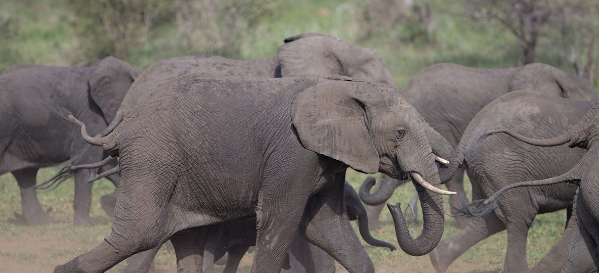
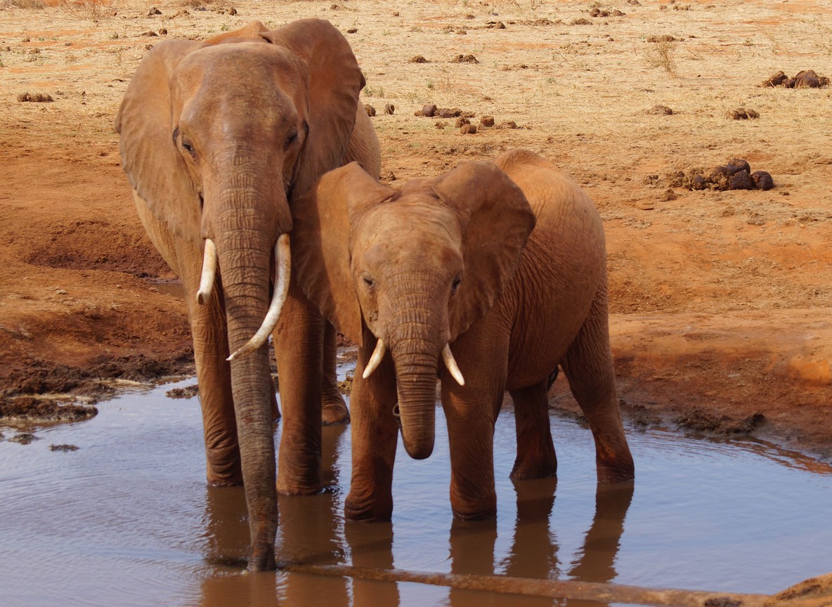
This is the single most famous thing about Tsavo National Park. The soil across much of Tsavo East is a fine, iron-rich laterite that turns a deep rust-red in the dry season. Elephants dust-bathe constantly to cool their skin and fend off insects, throwing loose earth over their backs with their trunks. In most parks that dust washes off gray. In Tsavo, it stains the elephants a deep orange-red that clings for days.
The best place to see this up close is Aruba Dam, a reservoir built in 1952 on the Voi River in Tsavo East. Herds gather here to drink and wallow, especially in the drier months when the Galana River basin dries out elsewhere. Tsavo’s elephant population also happens to be one of the largest in Kenya, with recent counts placing the combined Tsavo ecosystem herd in the tens of thousands, more than any other single Kenyan landscape. Seeing that many red-dusted elephants moving as one herd across open country is the image most visitors carry home.
The Man-Eaters of Tsavo: A 128-Year-Old Story
No feature explains Tsavo’s reputation quite like its lions. In 1898, two male lions began killing the Indian and African laborers building the Uganda Railway bridge over the Tsavo River, on what is now the Tsavo West side of the park. Work stopped for weeks as terrified crews refused to continue. Lieutenant Colonel John Henry Patterson, the engineer overseeing the bridge, eventually tracked and shot both lions after a nine-month ordeal. Patterson’s own published count put the toll at 28 workers. Later accounts, drawing on railway records, estimate as many as 135 deaths. The two lion skins were sold to Chicago’s Field Museum, where the reconstructed man-eaters of Tsavo remain on permanent display today.
The story also explains something visitors still notice on safari. Tsavo’s male lions are frequently maneless or thin-maned, a trait researchers link to the heat and thorny bush that would otherwise snag a full mane. They tend to form smaller prides than lions in cooler, more open parks like the Masai Mara, so a Tsavo sighting often feels quieter and more private.
Yatta Plateau: The World’s Longest Lava Flow
Running north to south through Tsavo East is the Yatta Plateau, a narrow ridge formed by lava that once poured from the Ol Doinyo Sabuk volcano. At approximately 290 km long, it is widely cited as the world’s longest single lava flow, though its width narrows to just a few kilometers in places. From the plains below, it looks like a long, flat-topped wall running to the horizon. Few visitors expect a volcanic feature this size inside a savannah park, which is exactly why it makes Tsavo’s list of famous landmarks. The Galana River runs along its base, and nearby Lugard Falls, a set of narrow rock rapids rather than a true waterfall, is one of the most photographed stops in Tsavo East.
Mzima Springs: The Clear-Water Surprise in Tsavo West
Cross into Tsavo West and the landscape changes completely. Mzima Springs pushes an estimated 50 million gallons of crystal-clear water out of volcanic rock every day, filtered for years through the Chyulu Hills before it reaches the surface. A submerged glass viewing chamber lets visitors watch hippos and crocodiles from below the waterline, one of the few places in East Africa where that is possible. The nearby Shetani lava flow, a field of black jagged rock near Chyulu Gate, is further proof that Tsavo’s volcanic history runs through both halves of the park, not just the Yatta side. Many Trunktrails Safaris tours and safaris pair a Mzima Springs morning with an Aruba Dam afternoon, so guests see both faces of Tsavo in a single day.
Tsavo East vs Tsavo West: Which Side Deserves Its Fame
Travelers often ask which half of Tsavo is worth prioritizing. The honest answer is that each side is famous for something different.
| Feature | Tsavo East | Tsavo West |
|---|---|---|
| Size | Approx. 13,747 km² | Approx. 9,065 km² |
| Signature feature | Red elephants, Aruba Dam, Yatta Plateau | Mzima Springs underwater hide, Shetani lava flow |
| Terrain | Open, flat savannah, red-earth plains | Volcanic hills, springs, denser bush |
| Man-eaters connection | Galana and Voi River region | Tsavo River railway bridge site |
| Best for | Wide-open game drives, large elephant herds | Scenery, geology, quieter cat sightings |
| Main gates | Voi, Buchuma, Manyani, Sala | Mtito Andei, Chyulu, Mbuyuni, Ziwani |
Many Trunktrails Safaris tours and safaris combine both parks over three to four days, since they share the same access corridor from Nairobi and the contrast between red plains and volcanic hills is part of the appeal.
Where to Stay: Camps Near the Red Elephants and Lava Fields
| Camp or Lodge | Location | Best For | Indicative Rate (per person/night) |
|---|---|---|---|
| Ashnil Aruba Lodge | Near Aruba Dam, Tsavo East | Red-elephant sightings, waterhole views | USD 200 to 320 |
| Voi Safari Lodge | Voi, Tsavo East escarpment | Floodlit waterhole, panoramic views | USD 180 to 300 |
| Satao Camp | Central Tsavo East | Tented camp on a natural waterhole | USD 250 to 400 |
| Kilaguni Serena Safari Lodge | Central Tsavo West | Kilimanjaro backdrop, waterhole game viewing | USD 250 to 400 |
| Finch Hattons Luxury Tented Camp | Near Mzima Springs, Tsavo West | Spring-fed grassland, lion prides | USD 450 to 750 |
The Trunktrails Advantage
Answering what Tsavo National Park is famous for is one thing. Planning a trip around it is another. Trunktrails Safaris builds every Tsavo itinerary around the actual sequence that makes sense on the ground, a dawn drive toward Aruba Dam for the red elephants, a midday stop at Lugard Falls, and camps chosen for current wildlife activity rather than marketing photos.
We handle the KWS gate logistics and the drive-versus-fly decision from Nairobi, and every Trunktrails Safaris itinerary comes with a written breakdown of park fees, camp rates, and transfer costs before you commit. We are a Kenyan-owned, TRA-licensed tour and safari operator, Licence No. TRA1/22/C01/92750. Our tours and safaris are run by guides who know Tsavo’s red-earth plains and volcanic hills firsthand, not a call center reading from a script. Trunktrails Safaris has built its reputation on getting travelers to the exact spots where Tsavo’s fame actually shows up in front of their eyes. 🌍
Ready to See Tsavo’s Red Elephants for Yourself?
Tsavo National Park earns its fame honestly. Rust-colored elephant herds at Aruba Dam, a lion story that changed how the world saw the species, and a lava flow long enough to rank among the planet’s biggest. Trunktrails Safaris can build your Tsavo itinerary around whichever piece of that fame draws you in most. 📸
Further reading
More safari planning resources
- Tsavo East and West map from SafariPure
- Map of Tsavo from Valley Safaris
- Tsavo complete guide on Touring Insights
- Tsavo destination guide on FindMySafari
WhatsApp the Trunktrails Safaris team at +254 113 208888 or email info@trunktrailssafaris.com. We will map out your Tsavo East and Tsavo West route, confirm current park fees, and match you with the camp closest to the sightings you want. Peak dry-season dates fill early, so reach out now to lock in your safari with Trunktrails Safaris.