
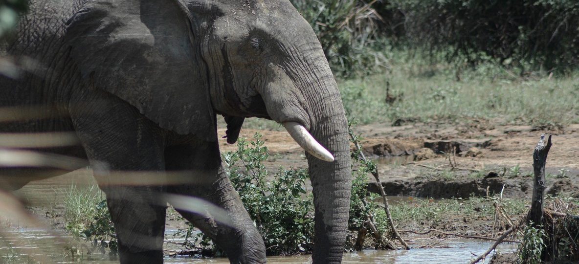
Inside the Tsavo Conservation Area: Kenya’s Largest Wildlife Sanctuary
The Tsavo Conservation Area is the single biggest block of protected wild land in Kenya, and most travelers only ever see one small corner of it. Stretched across more than 42,000 square kilometres of red-earth savanna, lava ridges, and riverine forest between Nairobi and the coast, it holds enough space to lose the crowds that gather in smaller reserves. Yet it is also one of the most misunderstood destinations on a Kenya itinerary, because it is not one park. It is a system.
This guide breaks down what the Tsavo Conservation Area actually includes, the real distances and fees involved in visiting it, and how to plan a trip that uses its scale rather than getting lost in it. Trunktrails Safaris builds Tsavo routes for travelers who want the red-dust elephants and the open horizon without wasting a single game drive. 🐘
What Is the Tsavo Conservation Area
The Tsavo Conservation Area is the umbrella name for the protected landscape built around Tsavo East National Park and Tsavo West National Park, Kenya’s two largest national parks. Together with Chyulu Hills National Park, South Kitui National Reserve, and a network of surrounding community conservancies and ranches, the full conservation area covers roughly 42,000 square kilometres, close to 4 percent of Kenya’s entire land area.
Tsavo East and Tsavo West alone combine for about 22,000 square kilometres, more than the size of Israel. The Kenya Wildlife Service manages the parks as one connected ecosystem because the wildlife, especially the elephant herds that made Tsavo famous, moves freely across the boundary lines that only exist on a map. A tours and safaris itinerary built around Tsavo has to account for that scale, because “visiting Tsavo” can mean very different drives depending on which section you choose.
Tsavo Conservation Area at a Glance: Real Numbers
Before booking, it helps to see the size, fees, and access points side by side. These are the numbers that shape how a Tsavo itinerary actually comes together.
| Area / Site | Size | Distance from Nairobi | Entrance Fee (non-resident adult, indicative) |
|---|---|---|---|
| Tsavo East National Park | Approx. 13,747 km2 | 330 km via Voi Gate / 4-5 hrs road | USD 50-60 per day |
| Tsavo West National Park | Approx. 9,065 km2 | 240 km via Mtito Andei Gate / 3-4 hrs road | USD 50-60 per day |
| Chyulu Hills National Park | Approx. 741 km2 | 270 km via Kibwezi / 4 hrs road | USD 25-35 per day |
| South Kitui National Reserve | Approx. 1,833 km2 | 350 km, unfenced, limited tourist infrastructure | Not routinely visited on standard safaris |
| Ngulia Rhino Sanctuary (inside Tsavo West) | Approx. 90 km2 fenced | Reached from Mtito Andei Gate | Included in Tsavo West park fee |
| Full Tsavo Conservation Area | Approx. 42,000 km2 | N/A (multi-gate system) | N/A |
Fees move with KWS policy updates and season, so treat these as planning ranges and confirm current gate rates at kws.go.ke before travel. Trunktrails Safaris checks live fees before every quote so nothing changes at the gate.
Tsavo East: Scale, Red Dust, and the Galana River
Tsavo East is the larger of the two parks and the more open. Flat, semi-arid plains stretch to the horizon, broken by the Yatta Plateau, the world’s longest lava flow at roughly 290 kilometres, and the Galana River, which cuts through the park and feeds Lugard Falls, a set of white-water rapids carved through volcanic rock.
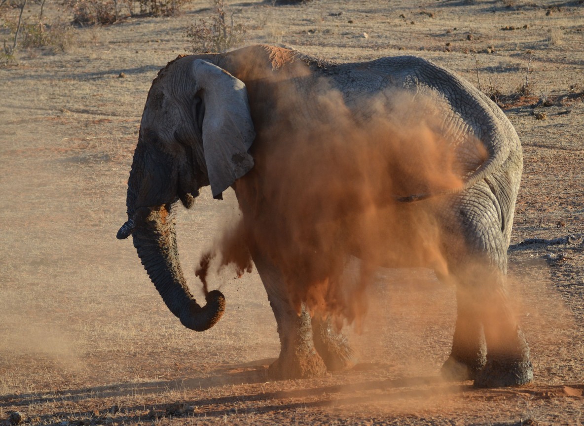
Tsavo East is best known for its elephants, which coat themselves in the park’s red laterite soil and have become one of Kenya’s most photographed sights. Voi Gate, on the Nairobi-Mombasa highway, is the main entry point, with Sala Gate and Manyani Gate serving the northern and southern sections. Voi Airport also runs scheduled flights for travelers skipping the road transfer.
Only the section south of the Galana River is open to tourism. The northern two-thirds of Tsavo East has been closed to visitors since 1970 to give wildlife an undisturbed core, which is part of why the park still supports large, genuinely wild herds despite its size.
Tsavo West: Springs, Volcanic Hills, and Big Game Country
Tsavo West is smaller but denser with scenery. Mzima Springs produces roughly 50 million gallons of crystal-clear water a day, filtered through volcanic rock from the Chyulu Hills, and its underwater viewing chamber gives visitors a rare eye-level look at hippos and crocodiles. Volcanic cones, lava flows, and the Ngulia Hills add elevation change that Tsavo East does not have.
Tsavo West also holds the Ngulia Rhino Sanctuary, a roughly 90 square kilometre fenced sanctuary protecting one of Kenya’s key black rhino populations, along with predator-rich plains around Rhino Valley and the Poachers Lookout viewpoint. Mtito Andei Gate, right on the Nairobi-Mombasa highway, is the main access point, with Chyulu Gate and Tsavo Gate serving other approaches. Kilaguni Airstrip handles scheduled and charter flights.
Chyulu Hills and the Wider Conservation Area
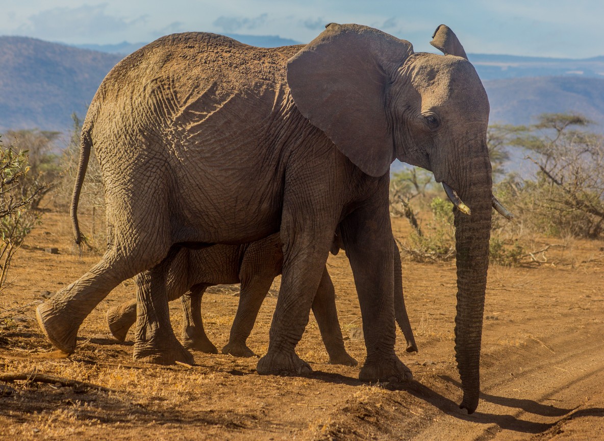
North of Tsavo West, the Chyulu Hills rise as a young volcanic range still soft-edged and green, unlike the older, weathered hills elsewhere in Kenya. Chyulu Hills National Park covers about 741 square kilometres and connects ecologically to both Tsavo West and Amboseli, forming part of a wider wildlife corridor that elephants use to move between the ecosystems.
South Kitui National Reserve, on the eastern edge of the conservation area, remains largely undeveloped for tourism and is not part of a standard Tsavo itinerary. The value of naming the full 42,000 square kilometre conservation area is less about visiting every corner and more about understanding why Tsavo’s wildlife, especially its elephant population, has room to roam that smaller, fenced reserves cannot offer.
The Man-Eaters, the Red Elephants, and Tsavo’s History
Tsavo carries one of Africa’s most famous wildlife stories. In 1898, two maneless lions, later called the Tsavo man-eaters, halted construction of the Kenya-Uganda Railway near the Tsavo River bridge after killing dozens of railway workers before being shot by engineer John Henry Patterson. The story shaped Tsavo’s reputation long before it became a national park in 1948, the same year it was split into the East and West sections still used today.
Tsavo’s elephants remain the park’s signature draw. The Tsavo Conservation Area is home to an estimated 14,000 elephants, among the largest single elephant populations left in Africa, and the red dust bathing behavior that gives them their nickname is a genuine adaptation, not a curiosity. The fine laterite soil coats their skin and helps protect them from sun and insects in a landscape with far less shade than the Maasai Mara.
Where to Stay Across the Tsavo Conservation Area
Camps and lodges cluster near each park’s main gates, and the right base depends on which section of Tsavo an itinerary emphasizes.
| Property | Section | Known For |
|---|---|---|
| Voi Safari Lodge | Tsavo East, near Voi Gate | Elevated views over a floodlit waterhole |
| Satao Camp | Tsavo East | Tented camp facing an active waterhole |
| Ashnil Aruba Lodge | Tsavo East, Aruba Dam | River and dam frontage, strong elephant sightings |
| Kilaguni Serena Safari Lodge | Tsavo West | Views toward Mount Kilimanjaro on clear days |
| Ngulia Safari Lodge | Tsavo West, Ngulia Hills | Elevated position above the rhino sanctuary |
| Finch Hattons Luxury Camp | Tsavo West, near Mzima Springs | Historic springs setting, high-end tented suites |
| Severin Safari Camp | Tsavo West | Mid-range tented camp near Mtito Andei |
Planning a Tsavo Conservation Area Safari
Tsavo sits directly on the Nairobi-Mombasa highway, which makes it the most practical park in Kenya to combine with a coastal extension. A common route runs Nairobi to Tsavo West via Mtito Andei Gate, across to Tsavo East via the internal Tsavo Gate, then on to Voi and down to Diani or Mombasa, all without doubling back.
Two to three nights gives enough time to cover both parks without rushing, though a single-night stop still works for travelers prioritizing the coast. The dry seasons, from June to October and January to February, concentrate wildlife around the Galana River and Mzima Springs and make for the clearest game viewing. The long rains from March to May bring lower rates and green scenery, though some tracks become harder to pass.
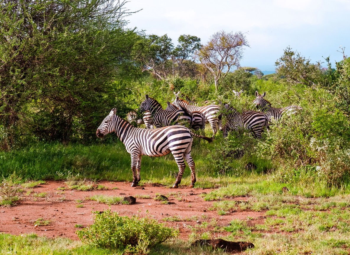
Tsavo vs the Maasai Mara: Which Fits Your Trip
Travelers weighing Tsavo against Kenya’s more famous reserve should compare what each actually delivers, not just the name recognition.
| Factor | Tsavo Conservation Area | Maasai Mara National Reserve |
|---|---|---|
| Size | Approx. 42,000 km2 (Tsavo East + West alone: 22,000 km2) | Approx. 1,510 km2 |
| Distance from Nairobi | 240-330 km / 3-5 hrs road | 270 km / 5-6 hrs road, 45 min flight |
| Crowd levels | Low, wide spacing between vehicles | High in peak migration season |
| Signature wildlife | Red-dust elephants, maneless lions, black rhino | Wildebeest migration, dense predator sightings |
| Best paired with | Diani Beach or Mombasa coastal extension | Serengeti cross-border extension |
The Trunktrails Advantage
Trunktrails Safaris is a Kenyan-owned tours and safaris operator, and we treat the Tsavo Conservation Area as the connected system it actually is, not a single stop on a checklist. Our guides know which gate saves two hours of driving, which section of Tsavo East has the active elephant herds this month, and when Ngulia Rhino Sanctuary is worth the detour inside Tsavo West.
Our tours and safaris packages route Tsavo deliberately, pairing a Voi Gate entry with a coastal handoff toward Diani so the same trip covers red-dust elephants and beach time without backtracking. Trunktrails Safaris also works with community conservancies bordering the parks, so fees paid on your trip support the same land management protecting the wildlife corridor between Tsavo and Chyulu Hills.
As a Kenyan-owned operator, Trunktrails Safaris prices its Tsavo tours and safaris directly, with no markup layered on through a foreign booking agent. That means the same expertise at a fairer rate. ✨
Ready to Explore the Tsavo Conservation Area
Kenya’s largest wildlife sanctuary rewards travelers who plan around its scale instead of treating it like a single park stop. Whether you want the open plains of Tsavo East, the springs and volcanic hills of Tsavo West, or a route that carries straight through to the coast, Trunktrails Safaris can map the gates, camps, and drive times that make it work.
Reach out to our tours and safaris team today and tell us how many days you have and whether the coast is part of the plan. We will build the Tsavo route around it.
Further reading
More safari planning resources
- Map of Tsavo from Valley Safaris
- Tsavo complete guide on Touring Insights
- Tsavo destination guide on FindMySafari
- Kenya national parks map from Valley Safaris
WhatsApp: +254 113 208888 Email: info@trunktrailssafaris.com Website: https://trunktrailssafaris.com
Tsavo’s dry season books up fast among travelers combining the parks with a coastal extension. Lock in your Trunktrails Safaris dates now before the best camps near Voi and Mtito Andei fill up. 🌍